Features
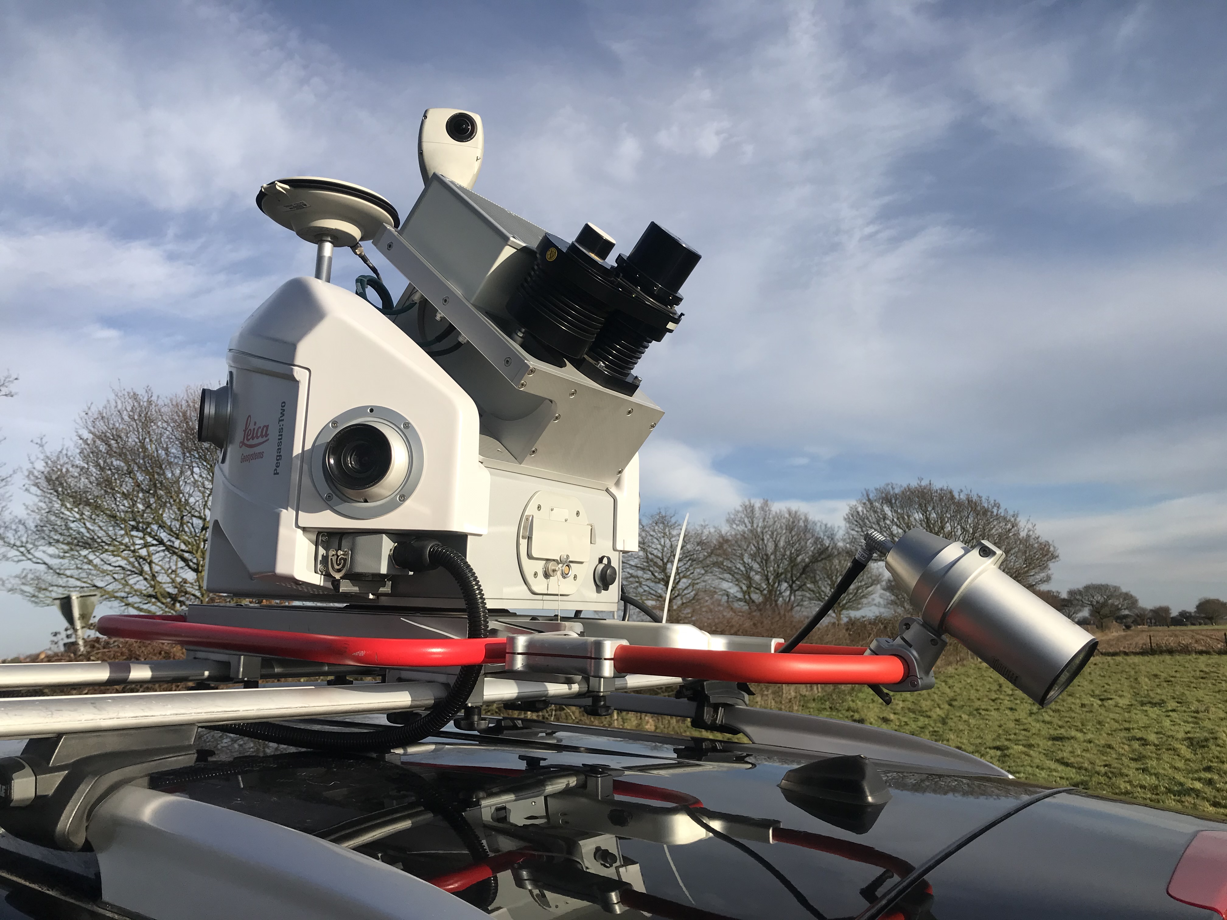
Street level imagery and point cloud data captured to your specification using a Leica Pegasus: Two Ultimate Mobile Mapping System
Enables the rapid and simultaneous collection of both high-resolution panoramic imagery and high density point cloud data from a moving vehicle
Capture imagery of specific areas such as airports, tow-paths, cycle paths and even inland waterways
Ability to undertake high quality, extensive topographical surveys, with no traffic management required which significantly reduces the risk to staff
Surveys undertaken in less time and at a fraction of the cost of a tradition survey
Data can be processed extremely efficiently and the extraction can be carried out directly into ESRI through Leica’s MapFactory
Data delivery options including hosting, streaming and GIS solutions

Geosense is a leading provider of aerial photography surveys in Africa. As experts in the acquisition, processing and delivery of high quality digital aerial photography, we offer tailor made vertical aerial photography surveys to meet your specific needs.
Usage
road mapping and navigation
waterways
emergency response planning
street asset management
highways projects
utilities infrastructure
Specifications
Geosense aerial imagery surveys are tailored to your specific requirements.
UltraCam Eagle camera systems available with either 100mm or 210mm lens to enable capture in the most difficult of air spaces due to air traffic control restrictions
Visionmap A3 RGB camera available for rapid capture
IGI DigiCam 60mp camera
Rollei 60mp Camera
IGI & Applanix IMU / INS for high accuracy with SOMAG stabilised mounts
Orthorectification and true orthorectification
Height creation DSM/DTM and contours
2D / 3D Photogrammetric Mapping 1:100 to 1:50,000
Image, height and mapping processing capabilities through UltraMap and ISAT/GXP softwares
We can also provide unmanned aerial vehicle (UAV) surveys, these are ideal for small site surveys such as golf courses and forestry plantations, and they can capture high resolution aerial imagery and derived data such as height and colour infrared data
Mobile Mapping Surveys


